Complete guides: •What Is Fauna?
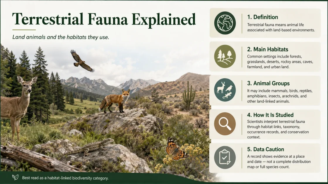
Terrestrial fauna is the animal life that lives on land or depends on land for feeding, shelter, movement, reproduction, or part of its life cycle. It includes animals on the ground, in vegetation, beneath the soil, inside caves, on exposed rock, and in terrestrial airspace. The term describes ecological use rather than a single branch of animal taxonomy: land-adapted lineages evolved independently among arthropods, vertebrates, molluscs, annelids, nematodes, tardigrades, rotifers, and other animal groups.[a]
Terrestrial Fauna Is Defined by Its Relationship with Land
“Terrestrial” is an ecological descriptor. It does not identify a class, order, family, or evolutionary branch. A beetle, earthworm, land snail, lizard, elephant, and owl may all belong to terrestrial fauna even though they occupy distant parts of the animal tree of life and use land in different ways.
The broad ecological meaning also differs from the narrower use of “terrestrial” in animal behaviour studies. In that narrower sense, a terrestrial animal may mean one that moves mainly on the ground rather than climbing, flying, or living below the surface. Under the broader fauna definition, arboreal mammals, tree-nesting birds, bats, soil invertebrates, cave animals, and ground-running reptiles can all be land-dependent animals.
| Land-use pattern | Where the animal spends much of its active life | Typical structural demands | Representative fauna |
|---|---|---|---|
| Ground-dwelling | Soil surface, litter, open ground, grass layer, or low vegetation | Walking or running surfaces, concealment, feeding sites, and refuge | Many hoofed mammals, ground beetles, tortoises, ground birds, and large flightless birds |
| Arboreal | Tree trunks, branches, canopy foliage, or suspended vegetation | Climbing surfaces, connected crowns, nesting cavities, fruit, foliage, or arboreal prey | Tree frogs, primates, squirrels, chameleons, canopy insects, and tree-dwelling snakes |
| Fossorial | Self-dug burrows or tunnel systems | Diggable substrate, suitable soil moisture, ventilation, and stable tunnel walls | Moles, mole-rats, burrowing reptiles, earthworms, termites, ants, and many beetle larvae |
| Subterranean or cave-associated | Natural caves, rock fissures, lava tubes, deep soil spaces, or groundwater-linked cavities | Stable temperature, darkness, humidity, roosting surfaces, and restricted food inputs | Cave-roosting bats, cave crickets, pseudoscorpions, spiders, millipedes, and specialized cave beetles |
| Rock-dwelling | Cliffs, boulder fields, scree, exposed outcrops, or rock crevices | Crevices, ledges, thermal surfaces, nesting sites, and escape routes | Rock lizards, cliff-nesting birds, pikas, mountain ungulates, spiders, and land snails |
| Land-dependent flying | Airspace above land, with terrestrial sites used for resting or reproduction | Roosts, nest sites, feeding habitat, connected flight routes, and seasonal resources | Bats, most insects, and many birds |
Land Animal Does Not Mean Ground Animal
An animal can be terrestrial without regularly standing on the ground. Canopy specialists, flying pollinators, tree-cavity nesters, soil fauna, and cave inhabitants remain dependent on land-based habitat structures.
The Boundary Between Terrestrial and Aquatic Fauna Is Not Absolute
Many animals cannot be assigned to land or water from a single observation. Classification may depend on the life stage, feeding environment, breeding site, resting site, or purpose of the dataset.
| Boundary case | Use of land | Use of water | Ecological treatment |
|---|---|---|---|
| Amphibians with aquatic larvae | Adults may forage, shelter, disperse, or overwinter on land | Eggs and larvae may develop in ponds, streams, wetlands, or temporary pools | Usually treated as amphibious fauna with both terrestrial and freshwater habitat requirements |
| Insects with aquatic immature stages | Adults may fly, feed, mate, and rest in terrestrial vegetation | Larvae or nymphs develop in water | The same species contributes to aquatic and terrestrial food webs at different life stages |
| Land crabs and land hermit crabs | Adults may forage and shelter mainly on land | Moisture, gill function, reproduction, or larval development may remain tied to water | Often described as terrestrial or semi-terrestrial according to the lineage and life stage |
| Sea turtles | Females use beaches for nesting and embryos develop on land | Feeding, growth, movement, and most adult life occur at sea | Normally treated as marine fauna with an essential terrestrial reproductive habitat |
| Seals and other pinnipeds | Land or ice is used for resting, moulting, mating, or giving birth | Feeding and much movement occur in marine waters | Normally treated as marine mammals rather than terrestrial mammals |
| Riparian and wetland mammals | Dens, feeding sites, travel routes, or refuge may occur on banks and floodplains | Swimming and aquatic feeding may form a regular part of daily activity | Classification depends on the species and the ecological question being studied |
A useful classification states what dependence is being measured. “Terrestrial adult,” “aquatic larva,” “marine feeder,” and “land-nesting species” are more informative than forcing every animal into a permanent land-or-water label.
The Main Habitat Systems Used by Land Animals
The IUCN Habitats Classification Scheme supplies standard habitat terms used in species assessments. Its broad classes include forest, savanna, shrubland, grassland, inland wetlands, rocky areas, caves and subterranean habitats, desert, and artificial terrestrial habitats.[b] These classes organize habitat associations; they do not imply that every species within one class uses the same resources.
| Habitat system | Structures that shape animal use | Common fauna patterns |
|---|---|---|
| Forest | Canopy layers, trunks, understory, dead wood, leaf litter, roots, cavities, streams, and soil | Vertical separation of species, arboreal movement, cavity nesting, litter decomposition, and strong dependence on vegetation structure |
| Savanna | Continuous or seasonal grass cover with scattered trees and shrubs | Grazing and browsing mammals, large predators, termites, dung fauna, ground birds, tree-dependent species, and seasonal movement around water and forage |
| Shrubland | Low woody cover, dense thickets, exposed soil, patchy herb layers, and seasonal flowers or fruit | Small mammals, reptiles, shrub-nesting birds, browsing animals, pollinating insects, and ambush predators |
| Grassland | Open herbaceous vegetation, deep root systems, sparse tree cover, and frequent fire or grazing | Running herbivores, burrowing mammals, ground-nesting birds, grasshoppers, ants, spiders, and predators using open sight lines |
| Inland wetland margins | Floodplains, marsh edges, saturated soils, temporary pools, reeds, banks, and changing water levels | Amphibious animals, wading birds, riparian mammals, moisture-dependent invertebrates, and species moving between water and dry refuge |
| Rocky areas | Cliffs, ledges, scree, boulders, shallow soils, crevices, and sun-exposed surfaces | Crevice refuge, cliff nesting, basking, short-distance vertical movement, and isolated microhabitat specialization |
| Caves and subterranean spaces | Darkness, limited primary production, stable temperatures, high humidity, narrow passages, and localized nutrient deposits | Roosting colonies, reduced vision in permanent cave residents, reliance on detritus or imported food, and restricted distributions |
| Desert | Low rainfall, sparse vegetation, exposed ground, dunes, rocky plains, salt surfaces, and large daily temperature shifts | Nocturnal activity, burrowing, water conservation, seasonal dormancy, heat avoidance, and rapid use of temporary food pulses |
| Artificial terrestrial habitat | Cropland, pasture, plantations, gardens, buildings, roadsides, mines, waste sites, and urban greenspace | Assemblages shaped by disturbance tolerance, food subsidies, pesticides, built structures, domestic animals, and fragmented habitat patches |
A Habitat Is More Than a Colored Land-Cover Patch
Habitat consists of the physical and biological conditions that allow a population to persist. Land cover may indicate forest, grassland, cropland, or bare ground, but it does not by itself show whether a species has suitable food, nesting material, soil depth, temperature, moisture, shelter, prey, breeding sites, or access to connected habitat.
A global study published in 2020 mapped 47 IUCN terrestrial habitat types for a 2015 reference year by combining land cover, climate, and land-use data. Validation with vertebrate occurrence data produced useful broad-scale results, but the authors also reported classification uncertainty and problems associated with occurrence-based validation.[c]
Habitat Conditions Operate at Several Scales
- Landscape scale: forest continuity, river corridors, mountain systems, grassland extent, roads, farms, settlements, and barriers between habitat patches.
- Habitat-patch scale: vegetation age, canopy cover, grazing pressure, fire history, water availability, tree density, and patch size.
- Microhabitat scale: one hollow tree, shaded rock crevice, rotting log, soil horizon, leaf-litter pocket, burrow entrance, nesting bank, or temporary pool.
- Seasonal scale: wet-season feeding areas, dry-season refuges, breeding grounds, winter dens, migration stopovers, and temporary flowering or fruiting resources.
- Life-stage scale: egg-laying sites, larval habitat, juvenile shelter, adult feeding areas, mating sites, and dispersal routes may occur in different places.
Two locations with the same broad habitat label may therefore support different animal communities. A mature forest with cavities, fallen wood, deep litter, and connected canopy does not provide the same conditions as a recently planted tree stand, even when both appear as tree cover on a coarse map.
Range, Recorded Presence, and Usable Habitat Are Different Measures
Species-distribution information is often presented as though every mapped area is occupied. In practice, a geographic range can contain unsuitable land cover, elevations, barriers, settlements, or habitat that is no longer usable. Area of Habitat attempts to refine a range by removing areas that do not match the species’ known habitat and elevation associations.[d]
| Evidence term | What it represents | What it does not establish by itself |
|---|---|---|
| Geographic range | A mapped boundary within which a species is known, expected, or inferred to occur | Continuous occupation of every location inside the boundary |
| Occurrence record | A documented observation, specimen, detection, or other report associated with a place and usually a date | Absence from unsampled places, population size, habitat quality, or permanent residency |
| Habitat association | A documented relationship between a species and one or more habitat classes or environmental conditions | Presence in every patch carrying the same broad habitat label |
| Area of Habitat | Habitat considered suitable within the wider range after unsuitable land cover or elevation is excluded | Confirmed occupancy of every remaining cell or patch |
| Home range | The area used by an individual or social group during normal activities | The full distribution of the species |
| Breeding evidence | A nest, eggs, dependent young, mating behaviour, occupied den, or another sign of reproduction | Year-round presence unless additional evidence supports it |
A Recorded Animal Is Not a Complete Distribution
An occurrence point documents reported evidence at a location. It should not be expanded into a continuous range without habitat, survey, temporal, and geographic support.
The Physical Problems of Living on Land
Independent animal lineages faced recurring problems when they moved from aquatic or moisture-saturated environments onto land. Research comparing animal genomes links terrestrialization with repeated changes involving water and salt regulation, environmental stress, immunity, metabolism, sensory perception, and reproduction.[g] The solutions differ among lineages because an insect exoskeleton, snail body, earthworm skin, and vertebrate skeleton begin from different anatomical conditions.
| Problem on land | Why it matters | Examples of biological responses |
|---|---|---|
| Water loss | Air can remove body water rapidly, especially in hot, dry, or windy habitats | Water-retaining skin or cuticle, shells, waxy surfaces, reduced exposed area, burrowing, nocturnal activity, concentrated waste, and water recovery from food |
| Body support | Water no longer supports body mass through buoyancy | Load-bearing limbs, strengthened skeletons, exoskeletons, muscular foot structures, low body profiles, and altered posture |
| Movement across uneven surfaces | Soil, rock, litter, sand, vegetation, and vertical surfaces create variable resistance | Jointed legs, claws, adhesive pads, scales, hooves, digging limbs, flexible bodies, jumping mechanisms, and climbing tails |
| Gas exchange | Respiratory surfaces must obtain oxygen while limiting drying | Lungs, tracheal systems, enclosed respiratory chambers, book lungs, and behaviour that keeps moisture-dependent surfaces wet |
| Reproduction away from open water | Gametes, embryos, and larvae can dry out | Internal fertilization, protected eggs, egg cases, nests, brooding, live birth, parental care, and reproduction timed to rainfall |
| Temperature variation | Land temperatures can change sharply between day and night, sun and shade, or surface and burrow | Basking, shade seeking, insulation, panting, sweating, torpor, hibernation, estivation, migration, and use of thermally stable retreats |
| Salt and waste balance | Water conservation changes how salts and nitrogenous wastes can be removed | Kidney specialization, uric acid production, salt glands, selective ion transport, and dry or concentrated excretion |
| Sensing through air | Light, sound, vibration, and chemical signals behave differently outside water | Air-adapted hearing, vision, antennae, olfactory systems, vibration detection, whiskers, and airborne communication signals |
Not every terrestrial animal has solved each problem in the same way or to the same degree. Earthworms remain tied to moist soil because gas exchange occurs across moist body surfaces. Desert beetles may tolerate exposed dry conditions through cuticular and behavioural controls. Land snails carry a shell that reduces exposure but may still depend on humid refuges. Amphibians can be active on land while retaining strong physiological and reproductive links to water.
Terrestrial Habitats Extend Upward and Downward
The visible ground surface is only one layer of terrestrial habitat. Animal communities may be separated vertically across canopy, bark, understory, litter, topsoil, deeper soil, rock fissures, caves, and the air above vegetation.
Canopy and Trunk Fauna
Tree crowns contain leaves, flowers, fruit, bark surfaces, cavities, epiphytes, accumulated organic material, prey, and escape routes. Some animals complete nearly their entire active lives above ground. Others move between canopy, understory, and forest floor as food, weather, reproduction, or predation risk changes.
Leaf-Litter and Dead-Wood Fauna
Leaf litter and decaying wood create humid, shaded microhabitats with fungi, microbes, plant fragments, and small prey. Springtails, mites, beetles, millipedes, woodlice, land snails, spiders, centipedes, amphibians, and small vertebrates may use this layer for feeding, shelter, egg laying, or overwintering.
Soil Fauna
Soil is a three-dimensional habitat containing mineral particles, organic matter, roots, pores, air, and water. Its animal community ranges from microscopic forms living in water films to earthworms, ants, termites, beetle larvae, burrowing reptiles, and fossorial mammals. Soil depth, texture, compaction, oxygen, moisture, chemistry, roots, and organic inputs determine which animals can persist.
Caves and Deep Subterranean Habitat
Permanent cave residents may face darkness, limited food, isolated passages, and stable but highly localized environmental conditions. Cave-roosting species that feed outside are ecologically different from animals completing their whole life cycle underground. Records should distinguish temporary cave users, roosting colonies, soil-associated species, and obligate subterranean fauna.
Land Animals Alter the Habitats They Occupy
Terrestrial animals are not passive occupants of vegetation and soil. Their feeding, movement, nesting, digging, waste, carcasses, and interactions with plants and other animals change nutrient pathways, soil structure, vegetation recruitment, and food-web relationships.
Decomposition and Soil Engineering
Earthworms, termites, ants, millipedes, woodlice, mites, insect larvae, and other soil or litter animals fragment organic material and interact with microbial decomposers. Digging animals create pores, redistribute soil, alter aeration and drainage, mix organic and mineral layers, and create microhabitats used by smaller organisms. FAO soil guidance identifies large invertebrates as soil ecosystem engineers because their physical activity affects other soil organisms and soil processes.[h]
Pollination and Plant Reproduction
Bees, flies, beetles, butterflies, moths, wasps, birds, bats, and other flower visitors can transfer pollen between flowers. The importance of each animal group varies among plant communities and regions. FAO describes pollination as an ecosystem process connecting wild and agricultural systems and supporting seed production in many flowering plants.[i]
Seed Movement and Vegetation Recruitment
Animals transport seeds externally, store them in caches, carry fruit away from parent plants, or deposit viable seeds after feeding. The outcome depends on seed treatment, movement distance, deposition site, and whether the animal destroys or disperses the seed. A fruit-eating animal is not automatically an effective seed disperser.
Herbivory, Predation, and Carcass Resources
Herbivores influence plant survival, growth, and competitive relationships. Predators alter prey mortality and behaviour. Scavengers and decomposers process carcasses and dung, moving nutrients into soil and food webs. These effects depend on population density, season, body size, diet, movement, and the surrounding animal community.
Why Habitat Names Cannot Produce a Complete Species List
Knowing that a site contains forest, desert, grassland, or shrubland narrows the possible fauna but does not confirm which species are present. Fauna composition also depends on geographic region, elevation, climate, isolation, habitat history, vegetation condition, water, soil, disturbance, survey season, detection method, and taxonomic coverage.
Opportunistic observations can document presence, but they usually lack standardized effort. They cannot establish true absence, population size, abundance, or the full composition of an animal community. Structured sampling records effort and can support stronger comparisons, especially when surveys target the whole assemblage rather than one species.[e]
Recorded Diversity Often Mirrors Survey Effort
Accessible roads, research stations, protected areas, cities, popular wildlife sites, and regions with active recording communities often accumulate more observations than remote or difficult terrain. Low record density can reflect limited sampling rather than low animal diversity. High record density can reflect repeated reporting of common or easily detected species.
Coordinates and Taxon Names Require Validation
Occurrence datasets may contain coordinates placed at country centroids, capital cities, institutions, rounded grid cells, duplicated observations, or locations with large uncertainty. Automated cleaning can flag likely problems, but flagged records still require case-by-case review rather than automatic deletion.[f]
Taxonomic names also change. A record may use a historical synonym, an outdated genus, an identification that has since been split into several species, or a name applied differently among datasets. A terrestrial fauna inventory should resolve the submitted name against a stated taxonomic reference while preserving the original identification for traceability.
Habitat Continuity Determines Whether Animals Can Use a Landscape
A habitat patch may contain food and shelter yet remain unusable if animals cannot reach it, leave it, find mates, move between seasonal resources, or escape disturbance. Roads, fences, canals, cleared land, intensive agriculture, buildings, and other barriers can divide populations or increase mortality during movement.
Road effects include direct habitat removal, collision mortality, noise, artificial light, chemical runoff, altered drainage, and reduced movement across the landscape. The severity varies with road width, traffic, animal behaviour, surrounding habitat, crossing design, and the location of breeding or migration routes.[j]
Connectivity Has Different Meanings for Different Animals
A narrow vegetated strip may connect habitat for a small insect or rodent but remain inadequate for a large carnivore. A tree-canopy gap may block an arboreal specialist while leaving ground movement open. A dry channel may connect desert mammals but fail to support moisture-dependent amphibians. Connectivity must therefore be evaluated for the focal species, life stage, movement distance, and season.
Pressures on Terrestrial Fauna Act Through Species and Habitat
Threats may kill animals directly, reduce reproduction, remove resources, alter habitat structure, isolate populations, introduce predators or pathogens, or shift the environmental conditions a species can tolerate. The IUCN threat classification separates pressures into categories such as development, agriculture, energy production, transport, biological resource use, human disturbance, natural-system modification, invasive species, pollution, geological events, and climate-related change.[k]
- Habitat conversion: replacement of native vegetation by intensive agriculture, settlement, extraction sites, or infrastructure.
- Habitat degradation: loss of cavities, dead wood, litter, prey, understory, water, or other resources while some broad vegetation cover remains.
- Fragmentation: division of continuous habitat into smaller or more isolated patches.
- Direct exploitation: hunting, trapping, collection, persecution, and incidental killing.
- Invasive organisms: predation, competition, disease transmission, hybridization, grazing, or habitat alteration by introduced species.
- Pollution: pesticides, heavy metals, plastics, nutrient loading, noise, artificial light, and contaminated soil or water.
- Changed fire or water regimes: altered frequency, intensity, timing, or extent of fire, flooding, drought, drainage, and water extraction.
- Climate-related change: temperature shifts, altered rainfall, extreme events, changing snow cover, sea-level effects on coastal habitat, and mismatches between animals and seasonal resources.
A threat label should not be converted automatically into a population trend. Evidence that a pressure exists does not by itself prove that a particular species is declining. Population trend requires assessment data, repeated surveys, demographic evidence, or another suitable line of evidence at a stated geographic scale and time period.
What a Defensible Terrestrial Fauna Checklist Must State
A terrestrial fauna checklist becomes scientifically useful only when its geographic, taxonomic, temporal, and evidential boundaries are visible. A list assembled from unfiltered web observations cannot be treated as a complete regional inventory.
| Checklist field | Information that should be recorded | Reason for inclusion |
|---|---|---|
| Geographic boundary | Country, island, protected area, watershed, coordinates, polygon, elevation limits, or another defined area | Prevents records from nearby but excluded locations from entering the list |
| Taxonomic scope | All animals or named groups such as mammals, reptiles, beetles, soil macrofauna, or land molluscs | Makes checklist completeness measurable within the selected groups |
| Accepted taxon | Accepted scientific name, authorship when needed, rank, family, and the taxonomic reference used | Separates currently accepted names from submitted names and synonyms |
| Original identification | Name exactly as supplied by the observation, specimen, publication, or dataset | Preserves the evidence trail when taxonomy changes |
| Evidence type | Specimen, observation, acoustic record, image, environmental DNA detection, literature record, track, nest, or other evidence | Shows how presence was documented |
| Date and source | Observation or collection date, dataset, institution, publication, record identifier, and access date | Distinguishes recent evidence from historical records and allows verification |
| Location quality | Coordinates, uncertainty, locality text, geodetic datum, and flags for centroids or impossible locations | Prevents false precision and supports spatial review |
| Terrestrial dependence | Fully terrestrial, arboreal, fossorial, cave-associated, semi-terrestrial, terrestrial adult, land-nesting, or another defined relationship | Makes boundary cases explicit rather than hiding them in a binary label |
| Habitat evidence | Observed microhabitat, habitat class, land cover, substrate, elevation, and relevant environmental conditions | Separates a location record from a verified habitat association |
| Regional status | Native, endemic, introduced, invasive, migrant, vagrant, captive, uncertain, or historical | Prevents every record from being treated as part of the resident native fauna |
| Breeding status | Confirmed, probable, possible, non-breeding, or not assessed, with the evidence used | Separates reproduction from temporary or seasonal presence |
| Conservation assessment | Assessment authority, category, geographic scale, assessment year, and population trend when reported | Avoids mixing global and regional categories or presenting an old assessment as current |
| Validation decision | Accepted, excluded, unresolved, duplicate, doubtful identification, location error, or outside scope | Records why each entry was retained or removed |
A checklist can be extensive without being complete. Its reliability depends on declared boundaries, traceable records, current taxonomy, repeatable filtering, and clear treatment of uncertain evidence.
Sources and Verification
- [a] Convergent genome evolution shaped the emergence of terrestrial animals — Used for independent animal terrestrialization events and the distinction between fully terrestrial and semi-terrestrial lineages.
- [b] IUCN Habitats Classification Scheme, Version 3.1 — Used for the standardized broad habitat classes applied in species assessments.
- [c] A global map of terrestrial habitat types — Used for the spatial mapping of IUCN terrestrial habitat classes, the 2015 reference scope, and reported validation limits.
- [d] Translating habitat class to land cover to map Area of Habitat of terrestrial vertebrates — Used for the distinction between species range, habitat association, land cover, and Area of Habitat.
- [e] GBIF Freshwater Data Publishing Guide — Used for the evidential differences between opportunistic occurrence records, targeted sampling, and assemblage sampling.
- [f] CoordinateCleaner: fast and standardized cleaning of species occurrence data — Used for coordinate-quality problems, spatial bias flags, and case-by-case validation of occurrence records.
- [g] How did animal life transition from aquatic to terrestrial environments? — Used for recurrent adaptations involving osmoregulation, stress response, immunity, metabolism, sensory systems, and reproduction.
- [h] FAO Indicators for assessment and monitoring of soil health — Used for the role of large soil invertebrates as ecosystem engineers affecting soil structure and other organisms.
- [i] FAO: What is pollinator management? — Used for animal pollination as an ecosystem process linking wild plant communities and agricultural systems.
- [j] Wildlife populations and road corridor intersections — Used for road mortality, habitat fragmentation, movement barriers, and effects on wildlife persistence.
- [k] IUCN Threats Classification Scheme, Version 3.3 — Used for the standardized categories of direct pressures recorded in species assessments.
Related Topics
- → Aquatic Fauna Explained: Freshwater and Marine Animal Life
- → How Scientists Classify Fauna by Region, Habitat, and Taxonomy
- → Endemic Fauna Explained: Why Some Animals Live Only in One Region
- → Native Fauna Explained: Meaning and Examples
- → Fauna vs Flora: Key Differences in Biology
- → Regional Fauna Explained: How Animal Life Changes by Geography