Complete guide: Regional Fauna Guides
Biogeographic regions are geographic units defined by recurring patterns in the distribution, evolutionary history, and turnover of living organisms. They do not simply divide Earth by continents, climate zones, or political borders. A region used for terrestrial mammals may differ from one designed for freshwater fish, coastal species, plants, or entire ecosystems.
Biogeographic Regions Describe Biological Difference Across Space
Biogeography examines where organisms occur, where they do not occur, and how geological history, isolation, dispersal, climate, extinction, and speciation produced those patterns. A biogeographic regionalization converts those patterns into named spatial units.
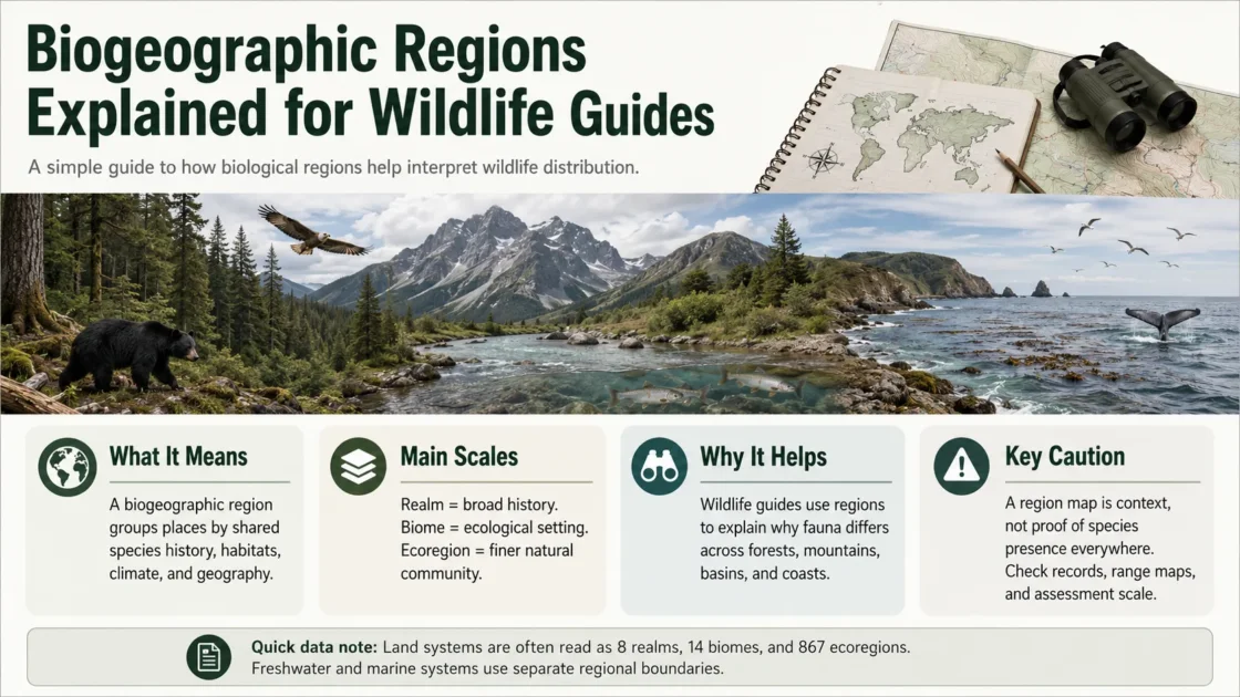
The units may be broad realms spanning much of a continent or smaller ecoregions representing distinctive assemblages of natural communities and species. The widely used Olson terrestrial classification defined an ecoregion as a relatively large land unit containing a distinct assemblage of natural communities and species. Its 2001 map organized 867 terrestrial ecoregions within 14 biomes and eight biogeographic realms.[a]
| Spatial term | What it primarily describes | Typical scale | Wildlife-guide use |
|---|---|---|---|
| Biogeographic realm | Very broad separation of biotas shaped by long evolutionary histories and major barriers | Continental or multicontinental | Places a fauna within a broad historical species pool |
| Zoogeographic region | A region defined from animal distributions; its rank and boundaries depend on the classification | Broad to intermediate | Useful when the source analysis is explicitly animal-based |
| Bioregion | An ecologically or biologically coherent area; the term does not have one fixed global rank | Intermediate | Useful only when the named classification and boundary source are stated |
| Province | A subdivision used between realms and ecoregions in some marine and historical systems | Intermediate | Often needed for coastal and marine fauna |
| Ecoregion | A regional unit containing distinctive communities, species assemblages, and environmental conditions | Regional | Supports habitat-based checklists and conservation comparisons |
| Biome | A broad ecological formation associated with climate, vegetation structure, or ecosystem function | Global but discontinuous | Describes habitat type rather than shared evolutionary history |
| Ecosystem realm | A major functional part of the biosphere, such as terrestrial, freshwater, or marine | Global | Separates ecosystem settings; it is not equivalent to a terrestrial biogeographic realm |
| Species range | The geographic distribution attributed to one taxon | Taxon-specific | Supports claims about an individual species rather than a regional classification |
Terrestrial Ecoregion Counts Depend on the Map Version
The 2001 Olson publication listed 867 terrestrial ecoregions. The later RESOLVE map uses 846 ecoregions grouped into the same broad set of 14 biomes and eight realms. A wildlife page should name the dataset version rather than combining names and totals from different releases.[b]
Why Faunal Boundaries Form
Long Isolation Produces Different Lineages
Oceans, continental separation, broad deserts, mountain systems, ice sheets, and other barriers can restrict movement over evolutionary time. Populations separated for long periods may diverge, while extinction removes lineages from one area but not another. The resulting faunas can remain different even where modern climates appear similar.
This is why a tropical forest biome does not identify one global fauna. Tropical moist forests occur in the Neotropics, Afrotropics, Indomalaya, and Australasia, but their mammals, birds, amphibians, reptiles, and invertebrates reflect different regional histories.
Climate and Habitat Filter Dispersal
Temperature, rainfall, seasonality, elevation, soil, water chemistry, vegetation, fire, and hydrology influence which organisms can survive after reaching an area. These ecological filters can reinforce an older geological division or create turnover within a single realm.
Barriers Differ Among Animal Groups
A saltwater channel may strongly separate non-flying mammals and freshwater fish while posing a weaker barrier to migratory birds. A high mountain ridge may divide lowland reptiles but connect cold-adapted upland species. A river may block some terrestrial animals while serving as the main dispersal corridor for aquatic fauna.
Biogeographic boundaries describe turnover in selected biological data. They are not physical walls that apply equally to every taxon.
The Eight Terrestrial Realms in the Olson–WWF System
The eight-realm terrestrial system is widely used in global conservation datasets and wildlife references. Realm names may appear in noun or adjective forms, such as Neotropic or Neotropical and Afrotropic or Afrotropical. The broad descriptions below are orientation summaries rather than substitutes for the source boundary layer.
| Terrestrial realm | Broad mapped scope | Meaning for a wildlife guide | Boundary caution |
|---|---|---|---|
| Nearctic | Most of Greenland and temperate North America, extending into northern Mexico under the terrestrial map | Provides a broad context for northern North American terrestrial faunas | Mexico contains strong Nearctic–Neotropical transitions that cannot be represented by a country label alone |
| Palearctic | Europe, North Africa north of the Sahara, and most temperate Eurasia | Links much of northern Eurasia within one broad historical faunal division | Southern and eastern margins grade toward Afrotropical and Indomalayan biotas |
| Neotropical | South America, Central America, the Caribbean, and tropical portions of Mexico | Provides a broad regional context for tropical American and South American fauna | High mountains, dry zones, islands, and southern temperate areas create strong internal divisions |
| Afrotropical | Most of sub-Saharan Africa, Madagascar, and associated islands in the terrestrial classification | Groups faunas south of the main Saharan barrier while retaining many separate ecoregions | Madagascar and other islands contain highly distinctive assemblages despite sharing the broad realm |
| Indomalayan | The Indian subcontinent and much of tropical and subtropical South and Southeast Asia west of the main Australasian transition | Provides context for continental and western Malesian tropical faunas | Himalayan gradients and the island chains of Southeast Asia create complex transition areas |
| Australasian | Australia, New Guinea, New Zealand, and parts of eastern Malesia in the Olson–WWF delineation | Represents terrestrial biotas with long histories of southern and island isolation | The western margin passes through Wallacea, where Asian and Australasian elements overlap |
| Oceania | Many remote Pacific island groups not assigned to the Australasian or Antarctic realms | Provides a broad unit for highly isolated island faunas | Individual archipelagos may have very different colonization histories and levels of endemism |
| Antarctic | Antarctica and associated southern islands in the terrestrial map | Separates the limited land fauna of the far south from adjacent marine systems | Most conspicuous Antarctic vertebrates depend heavily on marine food webs and should not be classified from a land map alone |
A realm assignment supplies broad historical context. It does not establish that a species occurs throughout the realm, occupies every biome within it, or is native to every country crossed by the realm boundary.
Animal Data Can Produce a Different Global Regionalization
Biogeographic maps change when researchers use different taxa, spatial data, similarity measures, or evolutionary information. A 2013 reassessment of Wallace’s zoogeographic regions combined distribution and phylogenetic data for 21,037 amphibian, bird, and mammal species. It identified 20 zoogeographic regions grouped into 11 larger realms rather than reproducing the eight-realm terrestrial map exactly.[c]
This does not make one map correct and the other incorrect. The two products were created for different analytical purposes. The Olson–WWF map synthesizes natural communities, species assemblages, and conservation units. The Holt analysis emphasizes animal distributions together with phylogenetic relationships.
A regional bird guide, mammal analysis, plant atlas, or amphibian study may therefore use boundaries that do not align perfectly. The guide should report the chosen source rather than presenting its region names as universal geographic facts.
Freshwater Fauna Follows Drainage History
Terrestrial realms are poorly suited to many freshwater questions. Fish and other obligate freshwater organisms move through connected rivers, lakes, wetlands, floodplains, and former drainage links. Watersheds, river capture, waterfalls, arid divides, glacial history, and changes in lake connections can be more influential than the terrestrial habitat surrounding the water.
Freshwater Ecoregions of the World introduced a global regionalization based primarily on the distributions and composition of freshwater fish, while also considering ecological and evolutionary patterns. The FEOW system recognizes 426 freshwater ecoregions.[d]
A terrestrial ecoregion and a freshwater ecoregion may cross each other because they represent different biological processes. A river can pass through forests, grasslands, and deserts while retaining aquatic relationships created by the wider drainage network. Conversely, two nearby rivers in the same terrestrial habitat can support different fish assemblages if their basins have remained isolated.
Coastal, Shelf, and Open-Ocean Fauna Need Different Boundaries
Marine distributions respond to water temperature, depth, currents, salinity, productivity, seafloor structure, coastlines, ocean basins, and barriers to larval or adult movement. A terrestrial realm ending at the coast cannot describe these patterns.
Marine Ecoregions of the World defines a nested coastal and shelf classification containing 12 realms, 62 provinces, and 232 ecoregions.[e] The mapped MEOW units extend from the intertidal zone to approximately the 200-metre depth contour, with a small outward buffer in the distributed GIS layer. Separate pelagic provinces are used for surface open-ocean waters.[f]
| Regionalization | Primary environment | Main biological basis | Reported global units | Appropriate wildlife use |
|---|---|---|---|---|
| Olson–WWF terrestrial ecoregions | Land | Natural communities, species assemblages, biomes, and broad historical realms | 867 ecoregions in the 2001 paper; 846 in the later RESOLVE layer | Terrestrial habitat and fauna references |
| Holt zoogeographic regions | Land | Distributions and phylogenetic relationships of amphibians, birds, and mammals | 20 regions grouped into 11 realms | Broad vertebrate biogeography and evolutionary comparisons |
| Freshwater Ecoregions of the World | Rivers, lakes, and connected inland waters | Freshwater fish composition, distribution, ecology, and evolutionary history | 426 freshwater ecoregions | Freshwater fish and inland aquatic biodiversity |
| Marine Ecoregions of the World | Coasts and continental shelves | Marine biodiversity patterns across coastal and shelf habitats | 12 realms, 62 provinces, and 232 ecoregions | Coastal and shelf species, habitats, and protected-area analysis |
| Pelagic Provinces of the World | Surface open-ocean waters | Broad pelagic biological and oceanographic patterns | 37 provinces grouped into four broad realms in the combined UNEP-WCMC product | Epipelagic and open-ocean fauna |
“Realm” Also Has a Different Meaning in Ecosystem Classification
The IUCN Global Ecosystem Typology uses realm for major functional parts of the biosphere, including terrestrial, freshwater, marine, subterranean, and atmospheric systems, together with transitional combinations. These ecosystem realms classify how ecosystems are organized and function. They are not the same units as the Nearctic, Palearctic, Neotropical, or other biogeographic realms.[g]
Two Meanings of “Terrestrial Realm”
In an ecosystem typology, terrestrial realm means the land-based part of the biosphere. In a biogeographic map, a terrestrial realm may mean a historical faunal division such as the Nearctic or Afrotropical realm. The classification name must accompany the term.
Transition Zones Are Biologically Real
Many maps display a clean line because a spatial dataset requires polygons. Biological turnover is often more gradual. Adjacent faunas may overlap across mountain foothills, peninsulas, island chains, river corridors, dry belts, or climatic gradients.
Wallacea Between Asian and Australasian Faunas
Wallacea, the island region between the Sunda Shelf and the Sahul Shelf, contains mixtures and replacements of lineages associated with Indomalayan and Australasian biotas. Deep-water channels limited repeated land connections even during periods of lower sea level. Different boundary proposals, including Wallace’s Line and related lines, emphasize different parts of this transition.
Elevation Creates Vertical Turnover
A single mapped ecoregion may include lowlands, slopes, isolated peaks, river valleys, and exposed ridges. Species associated with cloud forest, alpine grassland, dry valley, or lowland rainforest may occupy only a narrow elevational portion of that polygon.
Migratory Species Cross Several Units
Migratory birds, marine mammals, sea turtles, anadromous fish, insects, and wide-ranging predators may use multiple realms, provinces, ecoregions, or ecosystem types during one life cycle. Their breeding, non-breeding, passage, feeding, and dispersal areas should not be collapsed into one regional status.
Where Region Labels Change a Wildlife Checklist
- Country boundaries can combine several biological regions. A national checklist may contain species from different realms, ecoregions, drainage basins, islands, or marine provinces.
- A biome name cannot replace a faunal realm. Similar forest, grassland, or desert structures can support unrelated regional lineages.
- A realm-level species association is not local evidence. Presence somewhere in the Neotropical or Palearctic realm does not confirm occurrence at a particular site.
- Marine and freshwater records require their own spatial systems. Assigning fish or coastal invertebrates from a terrestrial polygon can conceal the processes controlling their distributions.
- Historical range and current occurrence are different evidence types. A species may be native to a region but locally extirpated, reintroduced, or known only from older specimens.
- Introduced, established, invasive, captive, and vagrant records should not be merged with native fauna. Each status answers a different biological question.
- Boundary records need spatial review. Coordinate uncertainty may place a record on either side of an ecoregion, watershed, coastline, or national border.
- Dataset versions can alter names, polygons, and totals. A checklist should retain the classification name and release used during analysis.
Evidence Fields Needed in a Regional Wildlife Guide
A reliable regional fauna entry needs more than a region name and a species name. Darwin Core separates occurrences, events, locations, identifications, taxa, and establishment information. Its terms include event date, occurrence status, establishment means, geographic coordinates, geodetic datum, and coordinate uncertainty.[h]
| Guide field | What should be recorded | Why it changes interpretation |
|---|---|---|
| Classification | System name, version, publication, or GIS release | Region names and boundaries may differ among sources |
| Spatial unit | Realm, region, province, ecoregion, basin, island, or another named level | Prevents a broad realm from being mistaken for a local distribution unit |
| Environmental system | Terrestrial, freshwater, coastal shelf, pelagic, subterranean, or transitional | Determines which regional map is biologically relevant |
| Focal taxon | The animal group used to create or evaluate the regionalization | Bird, mammal, amphibian, fish, plant, and invertebrate patterns may differ |
| Taxonomic identity | Accepted scientific name, identification source, and relevant synonym | Name changes can split or combine records assigned to the region |
| Occurrence date | Observation, collection, survey, or record interval | Separates current evidence from historical records |
| Occurrence status | Detected, not detected, or the status supplied by the source | A survey non-detection is not equivalent to confirmed absence from the region |
| Establishment means | Native, endemic, introduced, reintroduced, vagrant, or uncertain where supported | Prevents all recorded animals from being presented as native regional fauna |
| Coordinates and datum | Latitude, longitude, and spatial reference system | Allows the record to be tested against the correct regional polygon |
| Coordinate uncertainty | The radius or other measure describing location uncertainty | A point near a boundary may not support a confident regional assignment |
| Evidence basis | Human observation, specimen, machine observation, literature record, survey, or another documented basis | Different evidence types carry different verification and temporal limits |
Biogeographic Membership Does Not Prove Species Presence
A realm or ecoregion describes a broad assemblage pattern. It does not function as a complete species checklist. A species associated with an ecoregion may be restricted to one river, island, elevation band, soil type, breeding colony, cave system, or fragment of remaining habitat.
Regional presence should be supported by an official checklist, reviewed range map, specimen, survey, or documented occurrence record appropriate to the claim. Occurrence records document reported evidence at particular places and times; they do not by themselves define a complete range.
Absence of records also requires care. Sparse sampling, inaccessible terrain, seasonal survey timing, taxonomic uncertainty, withheld coordinates, and uneven publication can create apparent gaps. A region with few available records may be poorly sampled rather than biologically empty.
Selecting the Spatial Unit That Matches the Wildlife Question
- Use a biogeographic realm to describe broad evolutionary and continental-scale faunal relationships.
- Use a named zoogeographic regionalization when the analysis is based on a stated animal group and method.
- Use a terrestrial ecoregion for regional land communities, habitat representation, and land-based species assemblages.
- Use a freshwater ecoregion or drainage basin for river, lake, and inland aquatic fauna.
- Use a marine realm, province, or ecoregion for coastal and continental-shelf species.
- Use a pelagic province for open-ocean surface fauna rather than extending coastal polygons offshore.
- Use an ecosystem realm or functional ecosystem type when the question concerns ecosystem organization rather than historical faunal separation.
- Use species-level range and occurrence evidence when stating that a named animal occurs in a particular region.
The most defensible wildlife guide names the regional system, identifies its spatial level, separates terrestrial, freshwater, and marine evidence, and treats the regional label as context rather than proof of local presence.
Sources and Verification
- [a] Terrestrial Ecoregions of the World: A New Map of Life on Earth — Used for the terrestrial ecoregion definition and the original eight-realm, 14-biome, and 867-ecoregion classification.
- [b] RESOLVE Ecoregions of the World — Used for the later 846-terrestrial-ecoregion dataset and its organization within 14 biomes and eight realms.
- [c] An Update of Wallace’s Zoogeographic Regions of the World — Used for the phylogeny-informed analysis of 21,037 amphibian, bird, and mammal species and its 20 regions grouped into 11 realms.
- [d] Freshwater Ecoregions of the World: A New Map of Biogeographic Units for Freshwater Biodiversity Conservation — Used for the freshwater regionalization’s fish-distribution basis and global freshwater scope.
- [e] Marine Ecoregions of the World: A Bioregionalization of Coastal and Shelf Areas — Used for the MEOW hierarchy of 12 marine realms, 62 provinces, and 232 coastal and shelf ecoregions.
- [f] Marine Ecoregions and Pelagic Provinces of the World — Used for the distributed MEOW depth scope and the separate Pelagic Provinces of the World classification.
- [g] The New IUCN Global Ecosystem Typology — Used to distinguish functional ecosystem realms from historical terrestrial biogeographic realms.
- [h] Darwin Core Quick Reference Guide — Used for occurrence, event, location, establishment, status, coordinate, datum, and spatial-uncertainty fields relevant to regional wildlife records.
Related Topics
- → Wildlife of the Black Sea Region of Turkey
- → How Climate Zones Influence Regional Animal Diversity
- → Wildlife of Eastern Anatolia: Mountains, Steppes, and Wetlands
- → Endemic Animals of Turkey: Species Found Nowhere Else
- → Wild Ungulates of Turkey: Deer, Goats, Sheep, and Wild Boar
- → Mammals of Turkey: Native Species, Habitats, and Distribution